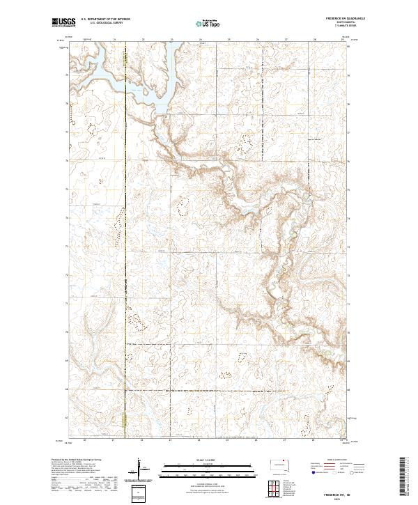
2021 Map of Frederick SW
USGS Topo · Published 2021About this map
The Elm River and Elm Lake define the drainage of this northern South Dakota landscape, where the waters cut through a high-plain topography of small wetlands and depressions. Spanning the McPherson Co Brown Co line, the map illustrates a strictly organized section-line road system, including routes such as 106th St and 373rd Ave, that partitions the land into precise agricultural squares. The meandering course of the river contrasts sharply with these rigid survey lines. Near the southern edge, the ephemeral Dry Run underscores the seasonal nature of water in this region, a vital factor for the homesteaders who established the farms and townships documented in this modern survey.
Find a feature on this map
24 named features on this map. Tap any name to fly to it.
Don’t see what you’re looking for? This feature index may not catch every label — zoom into the map to look around manually.
Map Details
Editions of this 2021 Frederick SW Map
This is the sole edition of this map. No revisions or reprints were ever made.
Other maps of this area

1894 · Ellendale
USGS Topo · 1:62,500

1899 · Ellendale
USGS Topo · 1:125,000

1952 · Richmond NE
USGS Topo · 1:24,000

1953 · Frederick
USGS Topo · 1:24,000

1953 · Ellendale South
USGS Topo · 1:24,000

1954 · Aberdeen
USGS Topo · 1:250,000

1956 · Aberdeen
USGS Topo · 1:250,000
1968 · Frederick NW
USGS Topo · 1:24,000

1968 · Forbes
USGS Topo · 1:24,000

1968 · Forbes SE
USGS Topo · 1:24,000