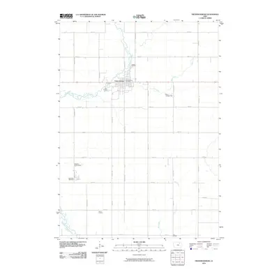
2010 Map of Fredericksburg
USGS Topo · Published 2010About this map
Fredericksburg stands at the center of this rural Chickasaw County landscape, defined by a rigid grid of agricultural roads and the winding course of the East Fork Wapsipinicon River. The town is the primary hub for the surrounding countryside, containing the Fredericksburg Post Office and serving as a focal point for the regional transportation network. The topography is shaped by several drainages, including Marsh Creek and Buck Creek, which carve through the farmland between major thoroughfares like Pembroke Ave and Union Ave.
Find a feature on this map
34 named features on this map. Tap any name to fly to it.
Don’t see what you’re looking for? This feature index may not catch every label — zoom into the map to look around manually.
Map Details
Editions of this 2010 Fredericksburg Map
This is the sole edition of this map. No revisions or reprints were ever made.
Other maps of this area

1954 · Mason City
USGS Topo · 1:250,000

1954 · Waterloo
USGS Topo · 1:250,000

1955 · Waterloo
USGS Topo · 1:250,000

1957 · Mason City
USGS Topo · 1:250,000

1958 · Mason City
USGS Topo · 1:250,000

1971 · Sumner
USGS Topo · 1:24,000

1971 · Alpha
USGS Topo · 1:24,000

1971 · Sumner SW
USGS Topo · 1:24,000

1971 · Fredericksburg
USGS Topo · 1:24,000

1971 · Frederika
USGS Topo · 1:24,000