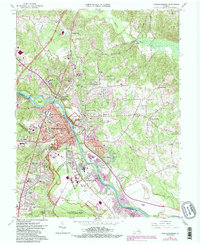
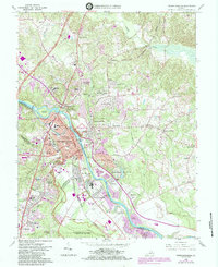
1966 Map of Fredericksburg
USGS Topo · Published 1984About this map
The Rappahannock River splits this 1966 landscape, separating the historic core of Fredericksburg from the village of Falmouth and the developing residential tracts of Stafford County. The map is a vital record of the preserved Civil War landscapes, showing the extensive Fredericksburg and Spotsylvania National Military Park and the Fredericksburg Battlefield alongside the National Cemetery.
Find a feature on this map
74 named features on this map. Tap any name to fly to it.
Don’t see what you’re looking for? This feature index may not catch every label — zoom into the map to look around manually.
Map Details
Editions of this 1966 Fredericksburg Map
5 editions found
Other maps of this area

1887 · Spottsylvania
USGS Topo · 1:125,000

1889 · Fredericksburg
USGS Topo · 1:125,000

1892 · Fredericksburg
USGS Topo · 1:125,000

1892 · Spottsylvania
USGS Topo · 1:125,000

1894 · Fredericksburg
USGS Topo · 1:125,000

1926 · Stafford
USGS Topo · 1:62,500

1931 · Stafford
USGS Topo · 1:62,500

1942 · Guinea
USGS Topo · 1:31,680

1942 · Spotsylania
USGS Topo · 1:31,680

1942 · Rappahannock Academy
USGS Topo · 1:31,680