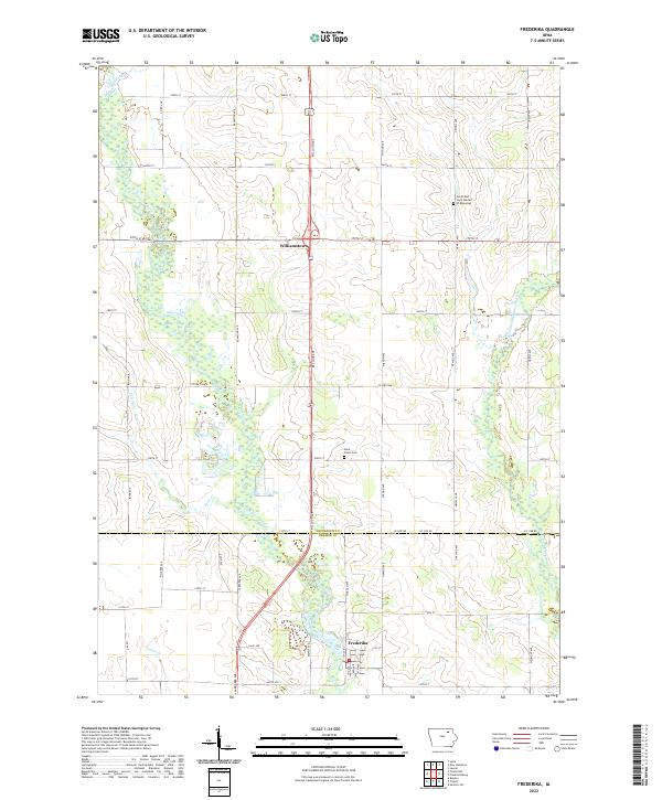
2022 Map of Frederika
USGS Topo · Published 2022About this map
Frederika sits along the southern edge of this survey where the Wapsipinicon River meanders through the landscape of southern Chickasaw and northern Bremer counties. The river valley defines the local geography, joined by smaller tributaries such as Crane Cr, Etter Cr, and the East Fork Wapsipinicon River. This modern topographic study reveals a rural area organized by a rigid section-line road grid, including McCloud Ave and Newell Ave, which connects the small settlement of Williamstown in the north to the more developed streets of Frederika. Local landmarks like Saint Johns Cem and the North East Iowa Garden of Memories offer specific points of interest for genealogists tracing family ties to these townships. The map provides a clear look at the intersection of natural drainage patterns and late-twentieth-century agricultural infrastructure.
Find a feature on this map
49 named features on this map. Tap any name to fly to it.
Don’t see what you’re looking for? This feature index may not catch every label — zoom into the map to look around manually.
Map Details
Editions of this 2022 Frederika Map
This is the sole edition of this map. No revisions or reprints were ever made.
Other maps of this area

1954 · Mason City
USGS Topo · 1:250,000

1954 · Waterloo
USGS Topo · 1:250,000

1955 · Waterloo
USGS Topo · 1:250,000

1957 · Mason City
USGS Topo · 1:250,000

1958 · Mason City
USGS Topo · 1:250,000

1971 · Bremer
USGS Topo · 1:24,000

1971 · Sumner SW
USGS Topo · 1:24,000

1971 · Tripoli NW
USGS Topo · 1:24,000

1971 · Fredericksburg
USGS Topo · 1:24,000

1971 · Frederika
USGS Topo · 1:24,000