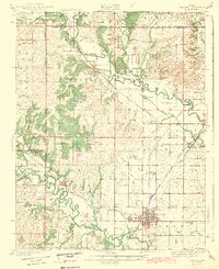
1943 Map of Fredonia
USGS Topo · Published 1943About this map
The confluence of the Verdigris River and the Fall River anchors this 1940s landscape in Wilson County, where a dense network of early rural schools reveals the settlement patterns of eastern Kansas. Fredonia serves as the regional hub, connected to outlying communities like New Albany and Coyville by three major railroads: the Atchison Topeka and Santa Fe, the St Louis and San Francisco, and the Missouri Pacific.
Find a feature on this map
80 named features on this map. Tap any name to fly to it.
Don’t see what you’re looking for? This feature index may not catch every label — zoom into the map to look around manually.
Map Details
Editions of this 1943 Fredonia Map
2 editions found

Other maps of this area

1885 · Eureka
USGS Topo · 1:125,000

1885 · Sedan
USGS Topo · 1:125,000

1886 · Fredonia
USGS Topo · 1:125,000

1886 · Independence
USGS Topo · 1:125,000

1888 · Eureka
USGS Topo · 1:125,000

1889 · Sedan
USGS Topo · 1:125,000

1894 · Fredonia
USGS Topo · 1:125,000

1894 · Independence
USGS Topo · 1:125,000

1894 · Eureka
USGS Topo · 1:125,000

1905 · Independence
USGS Topo · 1:125,000