2023 Map of Free Soil
USGS Topo · Published 2023About this map
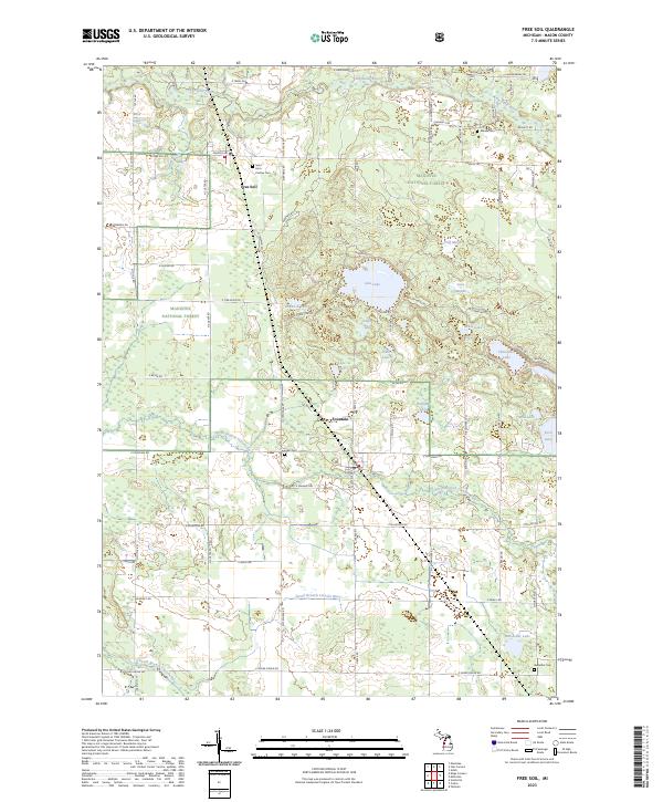
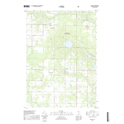
Free Soil and Fountain serve as the primary population centers in this northern Mason County landscape, where the Manistee National Forest covers much of the terrain. The area is defined by its complex hydrography, with the Big Sable River winding across the northern section while the North Branch Lincoln River and South Branch Lincoln River drain the southern reaches. Numerous small lakes, including Gun Lake, Lake Two, and Chancellor Lake, are scattered throughout the wooded sections, often accessed by a grid of rural routes such as N Custer Rd and Stephens Rd. For those researching family history, several burial sites are documented across the townships, including the Saint John Cantius Cem, Meade Cem, and Fountain Cem. The map illustrates a rural Michigan environment where forestry and small-town settlement remain the dominant features.
Find a feature on this map
70 named features on this map. Tap any name to fly to it.
Don’t see what you’re looking for? This feature index may not catch every label — zoom into the map to look around manually.
Map Details
Editions of this 2023 Free Soil Map
This is the sole edition of this map. No revisions or reprints were ever made.
Historical Maps of Free Soil Through Time
5 maps found
Featured Locations
- Meade Township, MI
- Sherman Township, MI
- Fountain, Sherman Township
- Free Soil, Free Soil Township
- Batcheller, Sheridan Township