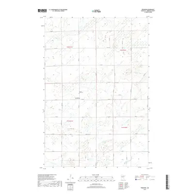
2019 Map of Freedhem
USGS Topo · Published 2019About this map
Freedhem serves as the primary settlement within this central Minnesota landscape, where the Freedhem Lutheran Cem marks a significant local historical point for genealogy research. The terrain is defined by a dense network of waterways and wetlands typical of Morrison County, including the winding course of the Platte River and numerous tributaries such as Big Mink Cr and Little Mink Cr. In the northern sections, Fletcher Cr and Wolf Cr drain toward localized basins like Thirtythree Lake. A rigid grid of county highways and local roads, such as Co HWY 45 and Jewel Rd, segments the landscape into agricultural and forest plots, reflecting the enduring township-and-range surveying system that continues to shape rural development in the region.
Find a feature on this map
42 named features on this map. Tap any name to fly to it.
Don’t see what you’re looking for? This feature index may not catch every label — zoom into the map to look around manually.
Map Details
Editions of this 2019 Freedhem Map
This is the sole edition of this map. No revisions or reprints were ever made.
Other maps of this area

1948 · Belle Prairie
USGS Topo · 1:62,500

1948 · Pierz
USGS Topo · 1:62,500

1948 · Lastrup
USGS Topo · 1:62,500

1948 · Little Falls
USGS Topo · 1:62,500

1950 · Lastrup
USGS Topo · 1:62,500

1950 · Belle Prairie
USGS Topo · 1:62,500

1950 · Little Falls
USGS Topo · 1:62,500

1950 · Pierz
USGS Topo · 1:62,500

1953 · Brainerd
USGS Topo · 1:250,000

1953 · Saint Cloud
USGS Topo · 1:250,000