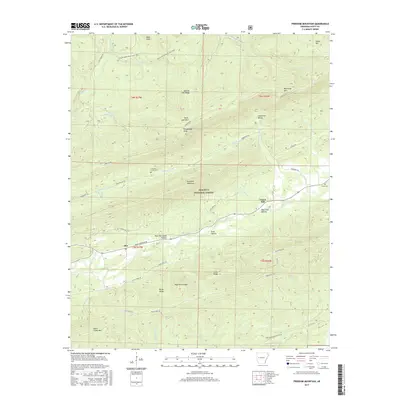
2017 Map of Freedom Mountain
USGS Topo · Published 2017About this map
Olio sits at the base of West Moreland Hollow in this 2017 study of the Ouachita National Forest. The landscape is defined by its significant relief, featuring the prominent summits of Freedom Mountain, Petit Jean Mtn, and Dutch Creek Mtn. These ridges separate a complex network of drainages, including the headwaters of Dutch Cr and Sugar Cr. For those researching local history, the presence of Freedom Creek Cem and Hunt Cem provides essential grounding in the rural settlement of Scott County. Modern recreation and legacy transport routes converge here, with the Sugar Creek Multi-Use Trail winding through the northern peaks near Bald Knob and Spanish Oak Ridge, while the historic path of Indian Trail Rd crosses the southern ridges. The survey captures a terrain where the high points like Kingdoodle Knob and High Point Ridge overlook deeply carved features such as Blue Hole Hollow and Coffee Pot Hollow.
Find a feature on this map
55 named features on this map. Tap any name to fly to it.
Don’t see what you’re looking for? This feature index may not catch every label — zoom into the map to look around manually.
Map Details
Editions of this 2017 Freedom Mountain Map
This is the sole edition of this map. No revisions or reprints were ever made.
Other maps of this area

1879 · Mountain Home
USGS Topo · 1:62,500

1887 · Magazine Mountain #4
USGS Topo · 1:62,500

1887 · Mount Ida #2
USGS Topo · 1:62,500

1887 · Magazine Mountain #3
USGS Topo · 1:62,500

1887 · Magazine Mountain
USGS Topo · 1:62,500

1890 · Magazine Mountain
USGS Topo · 1:125,000

1890 · Mount Ida
USGS Topo · 1:125,000

1934 · Booneville
USGS Topo · 1:48,000

1939 · Booneville
USGS Topo · 1:62,500

1955 · Little Rock
USGS Topo · 1:250,000