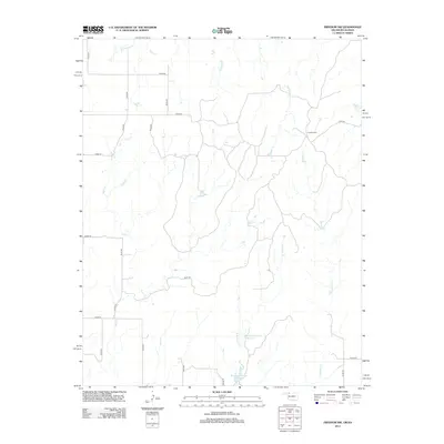
2012 Map of Freedom NW
USGS Topo · Published 2012About this map
Cowboy Cem serves as a small, significant landmark in this section of Woods County, situated near the headwaters of Moccasin Cr. The landscape is defined by a dense network of intermittent drainage systems, including Sand Cr and Mustang Cr, which flow through a region primarily organized by a strict sectional road grid. The presence of water management features like Burnham Number 9 Reservoir and Burnham Number 4 Reservoir suggests a reliance on captured surface water for local ranching or agricultural needs. This 2012 survey illustrates the enduring rural character of the Oklahoma-Kansas borderlands, where named features are sparse but deeply tied to the land's hydrology and the legacy of early settlers, as seen in the family or ranch-named drainages like Jug Motte Cr.
Find a feature on this map
26 named features on this map. Tap any name to fly to it.
Don’t see what you’re looking for? This feature index may not catch every label — zoom into the map to look around manually.
Map Details
Editions of this 2012 Freedom NW Map
This is the sole edition of this map. No revisions or reprints were ever made.
Other maps of this area

1892 · Coldwater
USGS Topo · 1:125,000

1955 · Woodward
USGS Topo · 1:250,000

1955 · Pratt
USGS Topo · 1:250,000

1958 · Woodward
USGS Topo · 1:250,000

1959 · Pratt
USGS Topo · 1:250,000

1970 · Lookout
USGS Topo · 1:24,000

1970 · Freedom NE
USGS Topo · 1:24,000

1970 · Freedom NW
USGS Topo · 1:24,000

1970 · Edith
USGS Topo · 1:24,000
1970 · Freedom
USGS Topo · 1:24,000