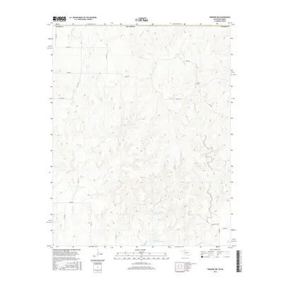
2016 Map of Freedom NW
USGS Topo · Published 2016About this map
Cowboy Cem stands as a quiet focal point in the eastern reaches of this portion of Woods County, Oklahoma. The landscape is defined by a dense network of seasonal drainages including Cottonwood Cr, Mustang Cr, and Sand Cr, which reveal the erosional patterns typical of this region's high plains. These intermittent streams carve through the terrain, eventually feeding into larger systems like Moccasin Creek.
Find a feature on this map
23 named features on this map. Tap any name to fly to it.
Don’t see what you’re looking for? This feature index may not catch every label — zoom into the map to look around manually.
Map Details
Editions of this 2016 Freedom NW Map
This is the sole edition of this map. No revisions or reprints were ever made.
Other maps of this area

1892 · Coldwater
USGS Topo · 1:125,000

1955 · Woodward
USGS Topo · 1:250,000

1955 · Pratt
USGS Topo · 1:250,000

1958 · Woodward
USGS Topo · 1:250,000

1959 · Pratt
USGS Topo · 1:250,000

1970 · Lookout
USGS Topo · 1:24,000

1970 · Freedom NE
USGS Topo · 1:24,000

1970 · Freedom NW
USGS Topo · 1:24,000

1970 · Edith
USGS Topo · 1:24,000
1970 · Freedom
USGS Topo · 1:24,000