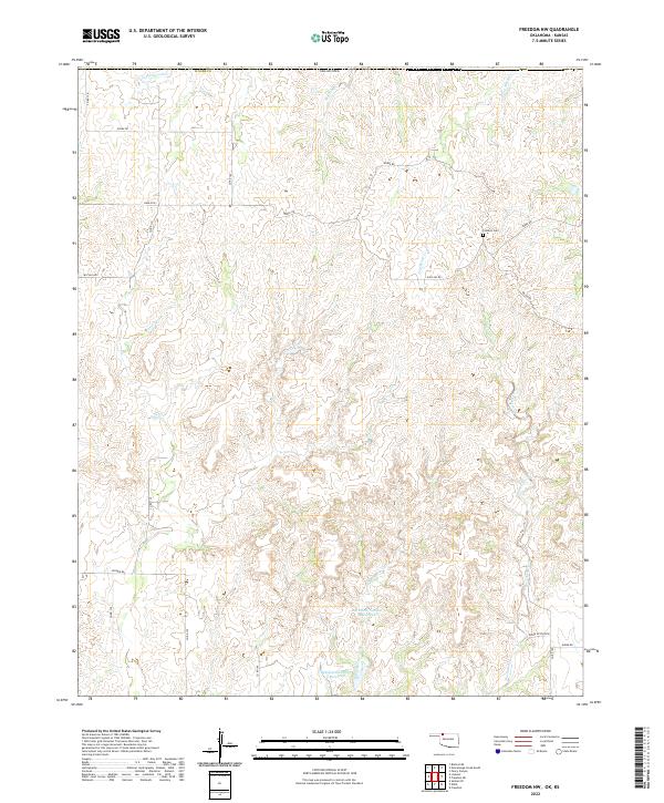
2022 Map of Freedom NW
USGS Topo · Published 2022About this map
The rolling grasslands of northwestern Woods County are defined by a network of seasonal drainages and local ranch roads. This landscape is shaped by the headwaters of several notable creeks, including the southward-flowing Sand Creek and the branching reaches of Moccasin Creek. The map shows a region predominantly used for grazing, where local water management is evident in the Burnham Number 3 Reservoir and Burnham Number 4 Reservoir situated along W Moccasin Creek.
Find a feature on this map
30 named features on this map. Tap any name to fly to it.
Don’t see what you’re looking for? This feature index may not catch every label — zoom into the map to look around manually.
Map Details
Editions of this 2022 Freedom NW Map
This is the sole edition of this map. No revisions or reprints were ever made.
Other maps of this area

1892 · Coldwater
USGS Topo · 1:125,000

1955 · Woodward
USGS Topo · 1:250,000

1955 · Pratt
USGS Topo · 1:250,000

1958 · Woodward
USGS Topo · 1:250,000

1959 · Pratt
USGS Topo · 1:250,000

1970 · Lookout
USGS Topo · 1:24,000

1970 · Freedom NE
USGS Topo · 1:24,000

1970 · Freedom NW
USGS Topo · 1:24,000

1970 · Edith
USGS Topo · 1:24,000
1970 · Freedom
USGS Topo · 1:24,000