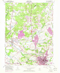
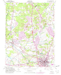
1953 Map of Freehold
USGS Topo · Published 1972About this map
Freehold and the surrounding townships of Madison, Marlboro, and Manalapan appear here during a transformative period of suburban expansion. While the borough of Freehold serves as a dense hub of activity with its Armory, Pumping Sta, and Sewage Disposal infrastructure, the outlying landscapes reveal a deep history of agrarian settlement and industry. Numerous mill sites are preserved in the nomenclature of the drainage basins, including Mounts Mills, Clarks Mills, Lafayette Mills, and Taylors Mills. The map also captures significant genealogical landmarks, most notably the Old Tennent Ch and its accompanying Old Tennent Cem, alongside the Old Scots Cem near Wickatunk. Transportation defines the area's layout, with the Central RR of New Jersey and Penn RR intersecting the region. Revisions from 1970 illustrate the rapid growth of housing developments between the traditional crossroads of Gordons Corner and Robertsville.
Find a feature on this map
53 named features on this map. Tap any name to fly to it.
Don’t see what you’re looking for? This feature index may not catch every label — zoom into the map to look around manually.
Map Details
Editions of this 1953 Freehold Map
5 editions found
Other maps of this area

1888 · New Brunswick
USGS Topo · 1:62,500

1888 · Asbury Park
USGS Topo · 1:62,500

1888 · Cassville
USGS Topo · 1:62,500

1888 · Sandy Hook
USGS Topo · 1:62,500

1893 · New Brunswick
USGS Topo · 1:62,500

1893 · Sandy Hook
USGS Topo · 1:62,500

1893 · Asbury Park
USGS Topo · 1:62,500

1894 · Cassville
USGS Topo · 1:62,500

1900 · Cassville
USGS Topo · 1:62,500

1901 · New Brunswick
USGS Topo · 1:62,500
Featured Places
- Old Bridge Township, NJ
- Monroe Township, NJ
- Marlboro Township, NJ
- Manalapan Township, NJ
- Freehold Township, NJ