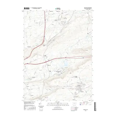
2016 Map of Freeland
USGS Topo · Published 2016About this map
Freeland and Upper Lehigh anchor the southeastern corner of this study, revealing a dense grid of streets and residential development situated against the northern edge of Buck Mtn. The landscape is defined by the high ridges of Nescopeck Mtn and Little Nescopeck Mtn, which frame a valley of scattered hamlets and water features. To the west, the community of Drums and the unique institutional site at Kis-Lyn occupy the lower elevations near Little Nescopeck Creek. Modern infrastructure is evident in the path of the interstate passing through Nescopeck Pass, while recreational development is visible around Lake of the Four Seasons and the Beech Mountain Lakes area. Smaller historical settlements like Pardeesville, Drifton, and Woodside show the enduring footprint of earlier coal-era villages, while the Saint Ann Cemetery provides a focal point for genealogical research in the Freeland vicinity.
Find a feature on this map
144 named features on this map. Tap any name to fly to it.
Don’t see what you’re looking for? This feature index may not catch every label — zoom into the map to look around manually.
Map Details
Editions of this 2016 Freeland Map
This is the sole edition of this map. No revisions or reprints were ever made.
Other maps of this area

1889 · Hazleton
USGS Topo · 1:62,500

1891 · Wilkesbarre
USGS Topo · 1:62,500

1891 · Hazleton
USGS Topo · 1:62,500

1892 · Mahanoy
USGS Topo · 1:62,500

1893 · Hazleton
USGS Topo · 1:62,500

1893 · Mahanoy
USGS Topo · 1:62,500

1894 · Shickshinny
USGS Topo · 1:62,500

1894 · Wilkesbarre
USGS Topo · 1:62,500

1943 · Scranton
USGS Topo · 1:125,000

1944 · Newark
USGS Topo · 1:250,000
Featured Places
- Freeland, PA
- Dorrance Township, PA
- Nescopeck Pass, Butler Township
- Sand Spring, Butler Township
- Highland, Foster Township