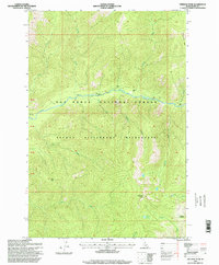
1995 Map of Freeman Peak
USGS Topo · Published 1999About this map
Selway Bitterroot Wilderness and the Nez Perce National Forest dominate this high-country landscape in Idaho County. The terrain is defined by its deep drainage basins and significant elevations, centered on the East Fork Moose Creek which gathers waters from numerous tributaries like Higgins Creek and Fitting Creek. This mid-1990s survey preserves the primitive state of the backcountry, where human presence is marked only by remote forest trails and high-altitude landmarks.
Find a feature on this map
26 named features on this map. Tap any name to fly to it.
Don’t see what you’re looking for? This feature index may not catch every label — zoom into the map to look around manually.
Map Details
Editions of this 1995 Freeman Peak Map
This is the sole edition of this map. No revisions or reprints were ever made.
Other maps of this area

1911 · Lolo
USGS Topo · 1:250,000

1913 · Lolo
USGS Topo · 1:250,000

1956 · Hamilton
USGS Topo · 1:250,000

1959 · Hamilton
USGS Topo · 1:250,000

1960 · Hamilton
USGS Topo · 1:250,000

1964 · Hamilton
USGS Topo · 1:250,000

1966 · Mc Connell Mtn
USGS Topo · 1:24,000

1966 · Twin Butte
USGS Topo · 1:24,000

1966 · Moose Ridge
USGS Topo · 1:24,000

1966 · Dog Creek
USGS Topo · 1:24,000