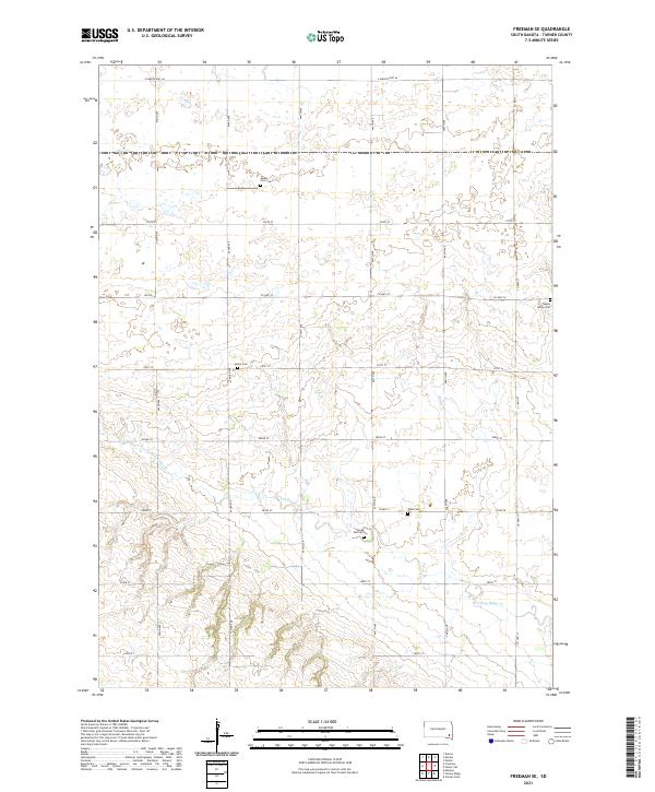
2021 Map of Freeman SE
USGS Topo · Published 2021About this map
Turkey Ridge Cr winds through this section of Turner County, south of the Missouri River plateau in southeastern South Dakota. The landscape is defined by the rigid grid of the Public Land Survey System, with gravel roads like 281st St and 444th Ave marking the township and range lines. This agricultural geometry is punctuated by small, significant local landmarks that speak to the region's pioneer heritage and religious settlement patterns.
Find a feature on this map
28 named features on this map. Tap any name to fly to it.
Don’t see what you’re looking for? This feature index may not catch every label — zoom into the map to look around manually.
Map Details
Editions of this 2021 Freeman SE Map
This is the sole edition of this map. No revisions or reprints were ever made.
Other maps of this area

1898 · Parker
USGS Topo · 1:125,000

1955 · Sioux Falls
USGS Topo · 1:250,000

1957 · Midway
USGS Topo · 1:24,000

1958 · Sioux Falls
USGS Topo · 1:250,000

1968 · Parker SW
USGS Topo · 1:24,000
1968 · Parker
USGS Topo · 1:24,000

1970 · Turkey Ridge
USGS Topo · 1:24,000

1970 · Freeman SE
USGS Topo · 1:24,000
1970 · Freeman
USGS Topo · 1:24,000
1970 · Center Point
USGS Topo · 1:24,000
Featured Places
- Marion Township, SD
- Rosefield Township, SD
- Spring Valley Township, SD
- Childstown Township, SD
- Norway Township, SD