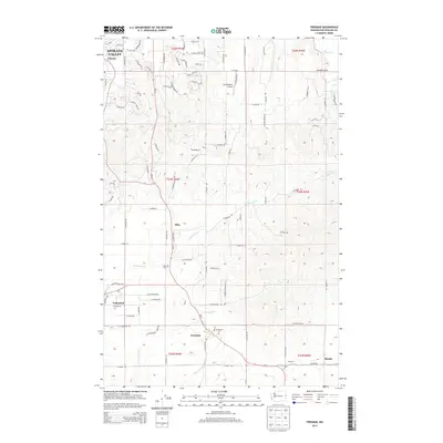
2014 Map of Freeman
USGS Topo · Published 2014About this map
Mica and Freeman serve as central points in this landscape where the suburban expansion of Spokane Valley meets the traditional agricultural and timber lands of the Palouse. The terrain is defined by the winding paths of California Cr and Cottonwood Cr, which carve through the rising hills south of Chester. Notable for local history, the map identifies established sites such as the Mica Cem and Evergreen Cem, alongside the Sky Meadows Airpark which reflects the area's mixed-use character. Small communities like Valleyford and Lockwood are mapped along the primary north-south transportation corridor, while the northeastern corner transitions into the open expanse of Saltese Flats. This survey provides a precise look at the rural-suburban interface at the start of the 2010s.
Find a feature on this map
57 named features on this map. Tap any name to fly to it.
Don’t see what you’re looking for? This feature index may not catch every label — zoom into the map to look around manually.
Map Details
Editions of this 2014 Freeman Map
This is the sole edition of this map. No revisions or reprints were ever made.
Other maps of this area

1901 · Spokane
USGS Topo · 1:125,000

1903 · Oakesdale
USGS Topo · 1:125,000

1905 · Oakesdale
USGS Topo · 1:125,000

1949 · Greenacres
USGS Topo · 1:62,500

1950 · Spokane NE
USGS Topo · 1:24,000

1950 · Spokane SE
USGS Topo · 1:24,000

1950 · Spokane
USGS Topo · 1:62,500

1951 · Greenacres
USGS Topo · 1:62,500

1954 · Spangle
USGS Topo · 1:62,500

1954 · Fairfield
USGS Topo · 1:62,500