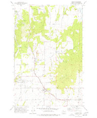
1973 Map of Freeman
USGS Topo · Published 1977About this map
Mica, Valleyford, and Freeman serve as the primary anchors of this landscape, reflecting a cluster of settlements defined by rail connections and extractive industry in the early 1970s. The Chicago Milwaukee St Paul and Pacific and Up railroads form the industrial backbone of the region, facilitating the movement of materials from various industrial sites like the Claypit, Sandpit, and Gravel Pit.
Find a feature on this map
58 named features on this map. Tap any name to fly to it.
Don’t see what you’re looking for? This feature index may not catch every label — zoom into the map to look around manually.
Map Details
Editions of this 1973 Freeman Map
This is the sole edition of this map. No revisions or reprints were ever made.
Other maps of this area

1901 · Spokane
USGS Topo · 1:125,000

1903 · Oakesdale
USGS Topo · 1:125,000

1905 · Oakesdale
USGS Topo · 1:125,000

1949 · Greenacres
USGS Topo · 1:62,500

1950 · Spokane NE
USGS Topo · 1:24,000

1950 · Spokane SE
USGS Topo · 1:24,000

1950 · Spokane
USGS Topo · 1:62,500

1951 · Greenacres
USGS Topo · 1:62,500

1954 · Spangle
USGS Topo · 1:62,500

1954 · Fairfield
USGS Topo · 1:62,500