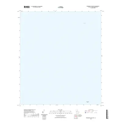
2020 Map of Freemason Island OE W
USGS Topo · Published 2020About this map
Chandeleur Sound dominates this coastal landscape in Saint Bernard Parish, representing a dynamic environment where the Gulf of Mexico meets the outer fringes of the Mississippi River delta. This survey captures a nearly purely maritime environment, focusing on the open waters and submerged features of the sound. The presence of Old Harbor Island in the southeastern corner provides a critical landmark for understanding the shifting barrier island systems of Louisiana. Because this is a modern topographic study, it reflects the contemporary state of these sensitive island chains, which are vital for coastal protection. Genealogists and local historians tracking family maritime history or commercial fishing patterns in the Louisiana marshlands will find this map essential for orienting historical records against the modern shoreline.
Find a feature on this map
2 named features on this map. Tap any name to fly to it.
Don’t see what you’re looking for? This feature index may not catch every label — zoom into the map to look around manually.
Map Details
Editions of this 2020 Freemason Island OE W Map
This is the sole edition of this map. No revisions or reprints were ever made.
Other maps of this area

1893 · Chandeleur
USGS Topo · 1:62,500

1935 · Mitchell Keys
USGS Topo · 1:31,680
1951 · Freemason Island
USGS Topo · 1:24,000
1954 · Mitchell Keys
USGS Topo · 1:31,680
1955 · Mitchell Key
USGS Topo · 1:24,000

1957 · Breton Sound
USGS Topo · 1:250,000

1961 · Breton Sound
USGS Topo · 1:250,000

1982 · North Islands
USGS Topo · 1:100,000
1983 · Black Bay
USGS Topo · 1:100,000
1994 · Mitchell Island
USGS Topo · 1:24,000