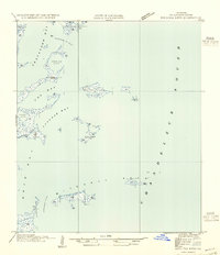
1954 Map of Mitchell Keys
USGS Topo · Published 1954About this map
Mitchell Keys and the surrounding marshy archipelagos of St. Bernard Parish are documented here during a period of transition, compiled from mid-1930s aerial photography and field exams. The map reveals the intricate coastline of the Mississippi River Delta's outer reaches, where the waters of Chandeleur Sound meet protected inlets like Cranetown Bay and Fox Bay. Navigational features such as Elephant Pt Pass and Keelboat Pass highlight the maritime nature of this landscape, which relied heavily on water-based travel and fishing. The presence of named landforms like Martin Island and Holmes Is suggests significant landmarks for local mariners and hunters in a region defined by shifting silts and tidal flow. This survey serves as a vital record of the Louisiana coast's configuration before significant twentieth-century subsidence and erosion altered these barrier features.
Find a feature on this map
12 named features on this map. Tap any name to fly to it.
Don’t see what you’re looking for? This feature index may not catch every label — zoom into the map to look around manually.
Map Details
Editions of this 1954 Mitchell Keys Map
This is the sole edition of this map. No revisions or reprints were ever made.
Other maps of this area

1893 · Cat Island
USGS Topo · 1:62,500

1893 · Chandeleur
USGS Topo · 1:62,500

1893 · Toulme
USGS Topo · 1:62,500

1895 · Bodreau
USGS Topo · 1:62,500

1935 · Morgan Harbor
USGS Topo · 1:31,680

1935 · Mitchell Keys
USGS Topo · 1:31,680

1946 · Oak Mound Bayou
USGS Topo · 1:31,680
1949 · Drum Bay
USGS Topo · 1:31,680
1949 · Door Point
USGS Topo · 1:31,680

1953 · Mobile
USGS Topo · 1:250,000