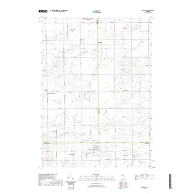
2019 Map of Freeport
USGS Topo · Published 2019About this map
Freeport sits at the southern edge of this West Michigan landscape, where the borders of Kent, Barry, and Ionia counties converge. The village is organized around a traditional grid featuring Oak St, Cherry St, and Main St, situated just south of the Coldwater River. This waterway and its numerous tributaries, such as Bear Creek and Messer Brook, dominate the local topography, shaping the rural development of Elmdale and Bowne Center. The map reveals a high concentration of small, family-associated cemeteries, including the Mennonite Cem and German Cem, which provide significant points of interest for genealogical research in this agricultural region. Public access is highlighted by the N Country National Scenic Trail, which winds north-to-south through the townships, crossing varied terrain near Lake Number Ten and Logan Lake.
Find a feature on this map
103 named features on this map. Tap any name to fly to it.
Don’t see what you’re looking for? This feature index may not catch every label — zoom into the map to look around manually.
Map Details
Editions of this 2019 Freeport Map
This is the sole edition of this map. No revisions or reprints were ever made.
Other maps of this area

1916 · Ionia
USGS Topo · 1:62,500

1918 · Ionia
USGS Topo · 1:62,500

1918 · Lowell
USGS Topo · 1:62,500

1943 · Ionia
USGS Topo · 1:62,500

1943 · Lowell
USGS Topo · 1:62,500

1950 · Nashville
USGS Topo · 1:62,500

1951 · Nashville
USGS Topo · 1:62,500

1951 · Hastings
USGS Topo · 1:62,500

1958 · Grand Rapids
USGS Topo · 1:250,000

1961 · Grand Rapids
USGS Topo · 1:250,000