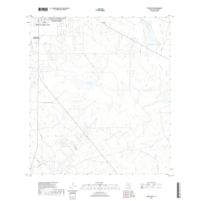
2019 Map of Freer South
USGS Topo · Published 2019About this map
Freer and its southern residential expansions anchor the northwest corner of this South Texas landscape. The map highlights the unique community structure of the region through several named residential developments including George W Ward Addition Colonia and the Williamson Addition Colonia. These settlements transition quickly into a landscape defined by ranching infrastructure and intermittent waterways.
Find a feature on this map
23 named features on this map. Tap any name to fly to it.
Don’t see what you’re looking for? This feature index may not catch every label — zoom into the map to look around manually.
Map Details
Editions of this 2019 Freer South Map
This is the sole edition of this map. No revisions or reprints were ever made.
Other maps of this area

1956 · Benavides
USGS Topo · 1:62,500

1956 · Rosita Ranch
USGS Topo · 1:62,500

1956 · Freer
USGS Topo · 1:62,500

1956 · Laredo
USGS Topo · 1:250,000

1968 · Benavides NW
USGS Topo · 1:24,000

1968 · Parrilla Creek NW
USGS Topo · 1:24,000

1968 · Parrilla Creek NE
USGS Topo · 1:24,000
1968 · Rosita
USGS Topo · 1:24,000
1969 · Rosita NW
USGS Topo · 1:24,000
1971 · Freer North
USGS Topo · 1:24,000