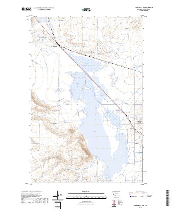
2024 Map of Freezeout Lake
USGS Topo · Published 2024About this map
Freezeout Lake and its surrounding wetlands dominate this landscape, illustrating the complex water management system of the Teton County prairie. This 2024 data highlights a sophisticated network of canals and natural drainage, where the North Supply Ditch and various numbered ponds like Pond Number One and Pond Number Four interface with the high ground of Greenfields Bench.
Find a feature on this map
36 named features on this map. Tap any name to fly to it.
Don’t see what you’re looking for? This feature index may not catch every label — zoom into the map to look around manually.
Map Details
Editions of this 2024 Freezeout Lake Map
This is the sole edition of this map. No revisions or reprints were ever made.
Other maps of this area

1886 · Great Falls
USGS Topo · 1:250,000

1920 · Choteau
USGS Topo · 1:125,000

1950 · Fairfield
USGS Topo · 1:62,500

1950 · Collins
USGS Topo · 1:62,500

1954 · Great Falls
USGS Topo · 1:250,000

1955 · Choteau
USGS Topo · 1:250,000

1957 · Choteau
USGS Topo · 1:250,000

1957 · Great Falls
USGS Topo · 1:250,000

1958 · Choteau
USGS Topo · 1:250,000

1960 · Choteau
USGS Topo · 1:62,500