
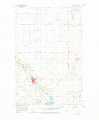
1960 Map of Choteau
USGS Topo · Published 1962About this map
The town of Choteau serves as a hub of irrigation and rail activity on the Rocky Mountain Front, situated where the Great Northern and the Chicago Milwaukee ST Paul And Pacific railroads converge. The landscape is heavily shaped by water management for agriculture, evidenced by the extensive network of the Eldorado Ditch, Farmers Ditch, and Teton Ditch across Burton Bench. Local landmarks like the Municipal Airport, Rodeo Ground, and Golf Course surround the town center, while smaller rural nodes like Agawam, Farmington, and Bole dot the prairie.
Find a feature on this map
46 named features on this map. Tap any name to fly to it.
Don’t see what you’re looking for? This feature index may not catch every label — zoom into the map to look around manually.
Map Details
Editions of this 1960 Choteau Map
2 editions found
Other maps of this area

1886 · Great Falls
USGS Topo · 1:250,000

1920 · Choteau
USGS Topo · 1:125,000

1920 · Dupuyer
USGS Topo · 1:125,000

1920 · Conrad
USGS Topo · 1:125,000

1936 · Pendroy
USGS Topo · 1:48,000

1938 · Gallup City
USGS Topo · 1:62,500

1941 · Pendroy
USGS Topo · 1:62,500

1942 · Gallup City
USGS Topo · 1:62,500

1950 · Fairfield
USGS Topo · 1:62,500

1950 · Collins
USGS Topo · 1:62,500