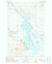
1987 Map of Freezeout Lake
USGS Topo · Published 1987About this map
Freezout Lake State Game Management Area dominates this landscape in Teton County, showcasing a complex of managed waterways including Freezout Lake, Davis Lake, and several numbered ponds. The 1980s terrain is characterized by alkaline basins and human-engineered water controls, visible in the extensive Road on Levee system and the North Supply Ditch. Notable elevation points like Priest Butte and Moehler Hill rise above the Alkali Flat and Roundup Coulee, providing significant landmarks in this wetland environment.
Find a feature on this map
20 named features on this map. Tap any name to fly to it.
Don’t see what you’re looking for? This feature index may not catch every label — zoom into the map to look around manually.
Map Details
Editions of this 1987 Freezeout Lake Map
This is the sole edition of this map. No revisions or reprints were ever made.
Other maps of this area

1886 · Great Falls
USGS Topo · 1:250,000

1920 · Choteau
USGS Topo · 1:125,000

1950 · Fairfield
USGS Topo · 1:62,500

1950 · Collins
USGS Topo · 1:62,500

1954 · Great Falls
USGS Topo · 1:250,000

1955 · Choteau
USGS Topo · 1:250,000

1957 · Choteau
USGS Topo · 1:250,000

1957 · Great Falls
USGS Topo · 1:250,000

1958 · Choteau
USGS Topo · 1:250,000

1960 · Choteau
USGS Topo · 1:62,500