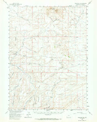
1958 Map of Freighter Gap
USGS Topo · Published 1967About this map
The Continental Divide winds through this high-altitude landscape in Sweetwater County, marking the watershed between the Pacific and Atlantic basins. This 1958 field survey reveals an arid, corrugated terrain characterized by the Jack Morrow Hills and the prominent Oregon Buttes in the north. The presence of the Stage Road and landmarks like Rock Cabin Spring and Freighter Gap underscore the historical importance of this corridor for transcontinental travel before modern highways. Water sources are scarce, represented by intermittent drainages such as Jack Morrow Creek, Alkali Wash, and Bush Creek. The map documents a sparsely settled region defined by its geology and the early tracks of pioneers and freighters, with family-named features like Kinch McKinney Hill providing clues to local land use during the mid-century era.
Find a feature on this map
26 named features on this map. Tap any name to fly to it.
Don’t see what you’re looking for? This feature index may not catch every label — zoom into the map to look around manually.
Map Details
Editions of this 1958 Freighter Gap Map
2 editions found

Other maps of this area

1954 · Rock Springs
USGS Topo · 1:250,000

1955 · Lander
USGS Topo · 1:250,000

1958 · Lander
USGS Topo · 1:250,000

1958 · Rock Springs
USGS Topo · 1:250,000

1958 · Parting of the Ways
USGS Topo · 1:62,500

1958 · Essex Mountain
USGS Topo · 1:62,500

1958 · Boars Tusk
USGS Topo · 1:62,500

1958 · Twelvemile Well
USGS Topo · 1:62,500

1958 · Hay Meadow Reservoir
USGS Topo · 1:24,000

1958 · Pacific Springs
USGS Topo · 1:24,000