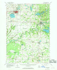
1958 Map of Fremont
USGS Topo · Published 1969About this map
The Muskegon River winds through the heart of this Newaygo County landscape, serving as a focal point for a region defined by its numerous glacial lakes and dense woodlots within the Manistee National Forest. This late-1950s survey captures the city of Fremont as a primary hub of activity, supported by the Chesapeake and Ohio railroad and the nearby Fremont Airport. The map reveals a highly developed rural infrastructure of the era, where the countryside is dotted with neighborhood-level landmarks such as Root Town Sch, Schenck Sch, and the Danish Ch Cem. Settlement patterns show a clear concentration around water bodies like Hess Lake and Kimball Lake, while the presence of numerous Gravel Pits suggests the local importance of aggregate mining for road building and regional development during Michigan's mid-century growth.
Find a feature on this map
126 named features on this map. Tap any name to fly to it.
Don’t see what you’re looking for? This feature index may not catch every label — zoom into the map to look around manually.
Map Details
Editions of this 1958 Fremont Map
2 editions found

Other maps of this area

1918 · Cedar Springs
USGS Topo · 1:62,500

1930 · Muskegon
USGS Topo · 1:62,500

1931 · Walkerville SE
USGS Topo · 1:31,680

1936 · Muskegon
USGS Topo · 1:62,500

1943 · Cedar Springs
USGS Topo · 1:62,500

1945 · Ravenna
USGS Topo · 1:62,500

1954 · Milwaukee
USGS Topo · 1:250,000

1954 · Midland
USGS Topo · 1:250,000

1958 · Midland
USGS Topo · 1:250,000

1958 · Milwaukee
USGS Topo · 1:250,000