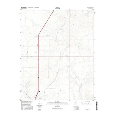
2017 Map of French
USGS Topo · Published 2017About this map
The Vermejo River and Canadian River converge in this high-plains landscape, where the settlement of French stands as a focal point for the regional transportation network. Irrigation infrastructure is prominent throughout the terrain, evidenced by the N Ditch, Highline Canal, and the City Reservoir located just north of Springer. This network of waterways supports the ranching and agricultural life of Colfax County, while several drainages like Dry Arroyo and Ladd Arroyo carve through the open country. Local movement relies on a series of rural routes such as Iron Horse Rd and Wildhorse Rd, which reflect the equestrian and ranching heritage of the area. The map illustrates a modern view of the convergence of the Cimarron River and Canadian systems, providing a clear record of the water management and land use patterns that define this New Mexico corridor.
Find a feature on this map
25 named features on this map. Tap any name to fly to it.
Don’t see what you’re looking for? This feature index may not catch every label — zoom into the map to look around manually.
Map Details
Editions of this 2017 French Map
This is the sole edition of this map. No revisions or reprints were ever made.
Other maps of this area

1915 · Koehler
USGS Topo · 1:62,500

1917 · Koehler
USGS Topo · 1:62,500

1954 · Raton
USGS Topo · 1:250,000

1958 · Raton
USGS Topo · 1:250,000

1964 · Pinon Hills
USGS Topo · 1:24,000

1965 · Abbott NW
USGS Topo · 1:24,000

1965 · French
USGS Topo · 1:24,000

1965 · Springer Lake
USGS Topo · 1:24,000

1965 · Taylor Springs
USGS Topo · 1:24,000

1965 · Springer
USGS Topo · 1:24,000