
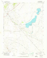
1965 Map of Springer Lake
USGS Topo · Published 1967About this map
The Beaubien and Miranda (Maxwell) land grant legacy defines this Colfax County landscape, where massive historic holdings transitioned into a complex network of irrigation and institutional use. Water management is the primary driver of the terrain, visible through the extensive Highline Canal, Springer Ditch, and a series of siphons and ditches feeding Springer Lake and No 3 Lake. These engineering features converted the high plains near the Cimarron River and Rayado Creek into productive ranching territory.
Find a feature on this map
21 named features on this map. Tap any name to fly to it.
Don’t see what you’re looking for? This feature index may not catch every label — zoom into the map to look around manually.
Map Details
Editions of this 1965 Springer Lake Map
This is the sole edition of this map. No revisions or reprints were ever made.
Other maps of this area

1915 · Koehler
USGS Topo · 1:62,500

1917 · Koehler
USGS Topo · 1:62,500

1954 · Raton
USGS Topo · 1:250,000

1955 · Cimarron
USGS Topo · 1:62,500

1956 · Miami
USGS Topo · 1:62,500

1958 · Raton
USGS Topo · 1:250,000

1964 · Pinon Hills
USGS Topo · 1:24,000

1965 · French
USGS Topo · 1:24,000

1965 · Springer
USGS Topo · 1:24,000
1971 · Colfax
USGS Topo · 1:24,000