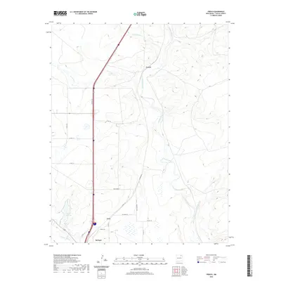
2020 Map of French
USGS Topo · Published 2020About this map
The Canadian River and its intricate drainage network dominate this part of Colfax County, where the high plains meet the river's winding course. This area serves as a critical junction for water and transport, with the Vermejo River and Ladd Arroyo feeding into the main channel from the north. The small settlement of French sits near the riverbanks, while further south, the community of Toril is situated near the northern outskirts of Springer. This landscape is defined by the transition from open range to the riparian corridors of the Cimarron River, which flows past the City Reservoir. The road network, including the local Vacquero Rd and Iron Horse Rd, follows the natural contours of the arroyos, reflecting how human settlement has adapted to the seasonal water flows and the plateau geography of northeastern New Mexico.
Find a feature on this map
24 named features on this map. Tap any name to fly to it.
Don’t see what you’re looking for? This feature index may not catch every label — zoom into the map to look around manually.
Map Details
Editions of this 2020 French Map
This is the sole edition of this map. No revisions or reprints were ever made.
Other maps of this area

1915 · Koehler
USGS Topo · 1:62,500

1917 · Koehler
USGS Topo · 1:62,500

1954 · Raton
USGS Topo · 1:250,000

1958 · Raton
USGS Topo · 1:250,000

1964 · Pinon Hills
USGS Topo · 1:24,000

1965 · Abbott NW
USGS Topo · 1:24,000

1965 · French
USGS Topo · 1:24,000

1965 · Springer Lake
USGS Topo · 1:24,000

1965 · Taylor Springs
USGS Topo · 1:24,000

1965 · Springer
USGS Topo · 1:24,000