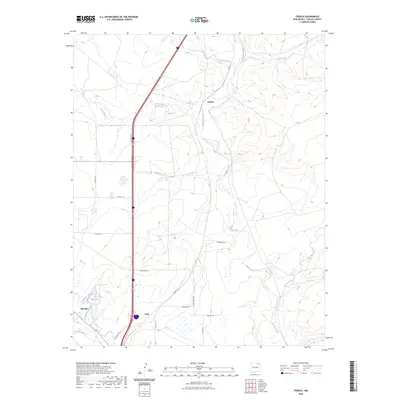
2023 Map of French
USGS Topo · Published 2023About this map
French and Toril sit at the intersection of high-desert watercourses and modern transit corridors in this high-plains landscape. The northern portion of the town of Springer appears in the southwest corner, situated where the Cimarron River joins the drainage networks of the western plains. This area is defined by its complex hydrology, featuring the confluence of the Vermejo River and the Canadian River, alongside man-made improvements like the Highline Canal and City Reservoir. A network of rural county roads, including Co Rd C-16 and Vacquero Rd, connects scattered ranchlands through a terrain carved by Ladd Arroyo and the Rio del Plano. The presence of Frontage Rd tracing the major north-south highway highlights the enduring importance of this corridor for movement through Colfax County.
Find a feature on this map
24 named features on this map. Tap any name to fly to it.
Don’t see what you’re looking for? This feature index may not catch every label — zoom into the map to look around manually.
Map Details
Editions of this 2023 French Map
This is the sole edition of this map. No revisions or reprints were ever made.
Other maps of this area

1915 · Koehler
USGS Topo · 1:62,500

1917 · Koehler
USGS Topo · 1:62,500

1954 · Raton
USGS Topo · 1:250,000

1958 · Raton
USGS Topo · 1:250,000

1964 · Pinon Hills
USGS Topo · 1:24,000

1965 · Abbott NW
USGS Topo · 1:24,000

1965 · French
USGS Topo · 1:24,000

1965 · Springer Lake
USGS Topo · 1:24,000

1965 · Taylor Springs
USGS Topo · 1:24,000

1965 · Springer
USGS Topo · 1:24,000