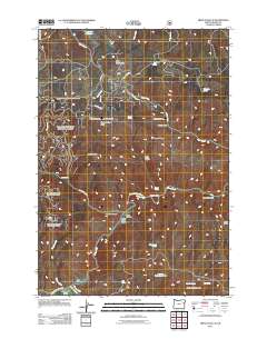
2011 Map of French Gulch
USGS Topo · Published 2011About this map
Bridgeport Valley sits at the southwestern edge of this landscape, where Marble Creek and Clarks Creek converge near the Burnt River. The terrain is defined by a complex network of canyons and high ridges, including Windy Ridge and Ebell Creek Divide, which separate the various drainages feeding into the river. This 2011 survey by the U. S. Geological Survey and the Forest Service documents a high-desert environment characterized by numerous seasonal water sources, such as Tule Spring and Ridge Top Spring Number Two.
Find a feature on this map
42 named features on this map. Tap any name to fly to it.
Don’t see what you’re looking for? This feature index may not catch every label — zoom into the map to look around manually.
Map Details
Editions of this 2011 French Gulch Map
This is the sole edition of this map. No revisions or reprints were ever made.
Other maps of this area

1901 · Baker City
USGS Topo · 1:125,000

1955 · Baker
USGS Topo · 1:250,000

1959 · Baker
USGS Topo · 1:250,000

1964 · Bridgeport
USGS Topo · 1:62,500

1964 · Ironside
USGS Topo · 1:62,500

1967 · Encina
USGS Topo · 1:24,000

1967 · French Gulch
USGS Topo · 1:24,000

1967 · Dooley Mtn
USGS Topo · 1:24,000

1967 · Lost Basin
USGS Topo · 1:24,000
1967 · Bowen Valley
USGS Topo · 1:24,000