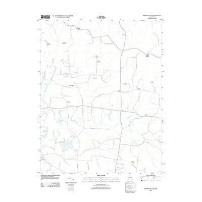
2011 Map of French Village
USGS Topo · Published 2011About this map
French Village sits at the northeastern corner of this landscape, where the waters of Plattin Creek and Terre Bleue Creek drain through a network of rural roads and homesteads. The terrain is marked by the Pike Run Hills to the north and the winding path of Big River in the southwest. A high concentration of family-named cemeteries, such as Perret Cemetery, Byington Cemetery, and Kerlagon Cemetery, suggests deep ancestral roots throughout the area. Small settlements like Hazel Run, Jaydee, and Thurman serve as local hubs, connected by routes like Hillsboro RD and Salem Church RD. Infrastructure for water management and forestry is evident through several lake dams and the French Village Lookout Tower, reflecting a geography defined by its woodland resources and multiple small watercourses, including Jacobs Creek and Salem Creek.
Find a feature on this map
92 named features on this map. Tap any name to fly to it.
Don’t see what you’re looking for? This feature index may not catch every label — zoom into the map to look around manually.
Map Details
Editions of this 2011 French Village Map
This is the sole edition of this map. No revisions or reprints were ever made.
Other maps of this area

1901 · De Soto
USGS Topo · 1:125,000

1904 · Farmington
USGS Topo · 1:62,500

1905 · Bonneterre
USGS Topo · 1:62,500

1906 · Farmington
USGS Topo · 1:62,500

1915 · Crystal City
USGS Topo · 1:62,500

1931 · De Soto SE
USGS Topo · 1:24,000

1949 · Saint Louis
USGS Topo · 1:250,000

1949 · Rolla
USGS Topo · 1:250,000

1949 · Crystal City
USGS Topo · 1:62,500

1953 · Rolla
USGS Topo · 1:250,000