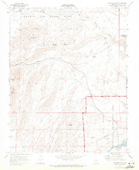
1970 Map of Frenchman Mtn.
USGS Topo · Published 1972About this map
Nellis Air Force Base occupies the northern edge of this Clark County landscape, where the flat valley floor meets the sharp ridges of Sunrise Mtn and Frenchman Mtn. This 1970 survey shows a region defined by complex desert geology and early resource extraction, marked by numerous Quarries, Prospects, and Mine workings scattered through the hills. Lake Mead Boulevard cuts a lone path eastward through the pass between the mountains, leading toward the Lake Mead National Recreation Area. The map reveals notable landmarks including the Natural Arch and the archeologically significant Gypsum Cave tucked near Gypsum Wash. In the south, the colorful sedimentary layers of Rainbow Gardens are prominent, while the Union Pacific rail line skirts the eastern edge near the Gale Hills, illustrating the intersection of military, industrial, and recreational interests in the Nevada desert.
Find a feature on this map
29 named features on this map. Tap any name to fly to it.
Don’t see what you’re looking for? This feature index may not catch every label — zoom into the map to look around manually.
Map Details
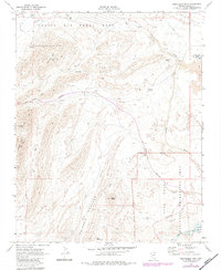
Editions of this 1970 Frenchman Mtn. Map
2 editions found
Other maps of this area

1886 · Saint Thomas
USGS Topo · 1:250,000

1893 · Saint Thomas
USGS Topo · 1:250,000

1907 · Las Vegas
USGS Topo · 1:250,000

1908 · Las Vegas
USGS Topo · 1:250,000

1926 · Boulder Canyon
USGS Topo · 1:96,000

1952 · Gass Peak
USGS Topo · 1:62,500

1952 · Dry Lake
USGS Topo · 1:62,500

1952 · Henderson
USGS Topo · 1:62,500

1952 · Las Vegas
USGS Topo · 1:62,500

1954 · Las Vegas
USGS Topo · 1:250,000