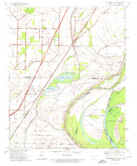
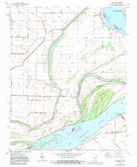
1970 Map of Frenchmans Bayou
USGS Topo · Published 1974This historical map portrays the area of Frenchmans Bayou in 1970, primarily covering Mississippi County as well as portions of Tennessee. Featuring a scale of 1:24000, this map provides a highly detailed snapshot of the terrain, roads, buildings, counties, and historical landmarks in the Frenchmans Bayou region at the time. Published in 1974, it is one of 2 known editions of this map due to revisions or reprints.
Find a feature on this map
44 named features on this map. Tap any name to fly to it.
Don’t see what you’re looking for? This feature index may not catch every label — zoom into the map to look around manually.
Map Details
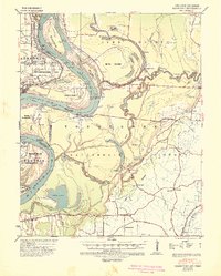
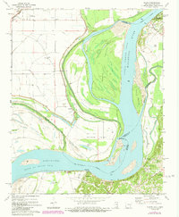
Editions of this 1970 Frenchmans Bayou Map
2 editions found
Historical Maps of Saint Thomas Through Time
10 maps found

1939 Evadale
Mississippi County, AR
1939 Hales Point
Mississippi County, AR

1952 Hales Point
Mississippi County, AR

1956 Evadale
Mississippi County, AR
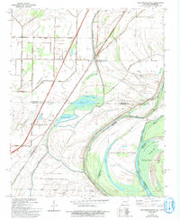
1970 Frenchmans Bayou
Mississippi County, AR
1972 Nodena
Mississippi County, AR
1972 Rosa
Mississippi County, AR
1983 Half Moon
Mississippi County, AR
1983 Manila North
Mississippi County, AR
1983 Manila South
Mississippi County, AR