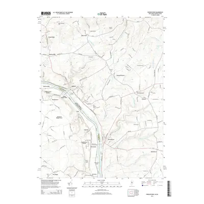
2014 Map of Frenchtown
USGS Topo · Published 2014About this map
The Delaware River forms a sharp natural boundary between New Jersey and Pennsylvania, where the settlements of Milford and Frenchtown anchor the riverbanks. This landscape is defined by its historic crossings and early transportation corridors, featuring notable landmarks like the Uhlerstown Covered Bridge and the Erwinna Covered Bridge. Away from the water, the terrain rises into Musconetcong Mtn, split by narrow valleys such as Sweet Hollow and Hermit Hollow. Several small airports, including Alexandria Airport and Malone Airport, are scattered among the ridges, while established communities like Everittstown and Baptistown sit at the intersections of winding rural roads. The concentration of local landmarks, including the Upper Tinicum Church and several cemeteries like Milford Union Cem, provides a detailed view of the region's settled history and community infrastructure during the early 21st century.
Find a feature on this map
163 named features on this map. Tap any name to fly to it.
Don’t see what you’re looking for? This feature index may not catch every label — zoom into the map to look around manually.
Map Details
Editions of this 2014 Frenchtown Map
This is the sole edition of this map. No revisions or reprints were ever made.
Other maps of this area

1890 · Easton
USGS Topo · 1:62,500

1890 · High Bridge
USGS Topo · 1:62,500

1890 · Lambertville
USGS Topo · 1:62,500

1890 · Doylestown
USGS Topo · 1:62,500

1891 · Easton
USGS Topo · 1:62,500

1891 · Lambertville
USGS Topo · 1:62,500

1891 · Doylestown
USGS Topo · 1:62,500

1894 · Lambertville
USGS Topo · 1:62,500

1898 · High Bridge
USGS Topo · 1:62,500

1900 · Raritan
USGS Topo · 1:125,000