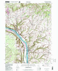
1997 Map of Frenchtown
USGS Topo · Published 1999About this map
The Delaware River carves a deep valley through the high ground of the Musconetcong Mountain and Riegel Ridge area, defining the border between Hunterdon County and Bucks County. Riverfront settlements such as Frenchtown, Milford, and Upper Black Eddy serve as historic nodes of activity along this aquatic corridor. The landscape is characterized by steep ravines cut by waterways like Nishisakawick Creek and Hakihokake Creek, which drain the agricultural and wooded uplands where smaller hamlets like Baptistown and Mount Pleasant are situated. Large tracts of protected territory, including State Game Lands No 56, dominate the Pennsylvania side, while the New Jersey side shows a pattern of rural development around sites like the Alexandria Cem and the Township Sch. Industrial and utility markers, such as a Power House and a Landing Strip, indicate the modern infrastructure integrated into this river-valley geography.
Find a feature on this map
43 named features on this map. Tap any name to fly to it.
Don’t see what you’re looking for? This feature index may not catch every label — zoom into the map to look around manually.
Map Details
Editions of this 1997 Frenchtown Map
This is the sole edition of this map. No revisions or reprints were ever made.
Other maps of this area

1890 · Easton
USGS Topo · 1:62,500

1890 · High Bridge
USGS Topo · 1:62,500

1890 · Lambertville
USGS Topo · 1:62,500

1890 · Doylestown
USGS Topo · 1:62,500

1891 · Easton
USGS Topo · 1:62,500

1891 · Lambertville
USGS Topo · 1:62,500

1891 · Doylestown
USGS Topo · 1:62,500

1894 · Lambertville
USGS Topo · 1:62,500

1898 · High Bridge
USGS Topo · 1:62,500

1900 · Raritan
USGS Topo · 1:125,000