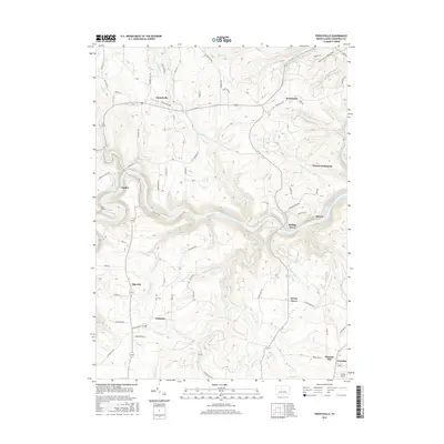
2016 Map of Frenchville
USGS Topo · Published 2016About this map
The West Branch Susquehanna River carves a deep, winding path through this portion of Clearfield County, defining the local geography and historical settlement patterns. Along the northern plateau, the community of Frenchville sits near the headwaters of Sandy Creek, while the Guenot Settlement reflects the area's distinct cultural heritage further east near Keewaydin. The terrain is deeply incised by numerous tributaries, including Rolling Stone Run and Alder Run, which drain the ridges where small rural centers like Sylvan Grove and Palestine are situated. A network of winding roads, such as Caledonia Pike and Keewaydin Rd, connects these upland communities. In the southeastern corner, the landscape transitions toward Grassflat, marked by the presence of Folmar Airport and the narrow valley of Basin Run.
Find a feature on this map
70 named features on this map. Tap any name to fly to it.
Don’t see what you’re looking for? This feature index may not catch every label — zoom into the map to look around manually.
Map Details
Editions of this 2016 Frenchville Map
This is the sole edition of this map. No revisions or reprints were ever made.
Other maps of this area

1903 · Houtzdale
USGS Topo · 1:62,500

1905 · Houtzdale
USGS Topo · 1:62,500

1922 · Philipsburg
USGS Topo · 1:62,500

1929 · Karthaus
USGS Topo · 1:62,500

1929 · Clearfield
USGS Topo · 1:48,000

1932 · Clearfield
USGS Topo · 1:62,500

1932 · Karthaus
USGS Topo · 1:62,500

1939 · Philipsburg
USGS Topo · 1:62,500

1945 · Philipsburg
USGS Topo · 1:62,500
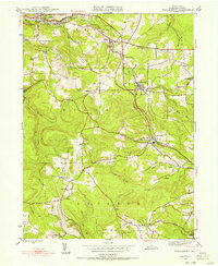
1945 · Wallaceton
USGS Topo · 1:24,000
Featured Places
- Karthaus Township, PA
- Cooper Township, PA
- Frenchville, Covington Township
- Pleasant Hill, Cooper Township
- Coudley, Girard Township