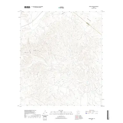
2019 Map of Fresno Creek
USGS Topo · Published 2019About this map
Panther Mtn and the intricate drainage networks of the Trans-Pecos region define this high-desert landscape in Pecos and Brewster Counties. The terrain is characterized by a series of deep canyons and seasonal watercourses, including Sanderson Canyon and Little Brindle Canyon, which cut through the limestone ridges of West Texas. Flowing towards the southern edge of the sheet, Fresno Cr and Maxon Cr serve as the primary topographic markers in an area defined by elevation extremes. Smaller geographical features like Panther Gulch, Kincaid Canyon, and McRae Canyon illustrate the complex erosion patterns common to this arid environment. The map also clearly delineates the Pecos County and Brewster County boundary line as it traverses the high ridges and deep draws of the canyon country.
Find a feature on this map
11 named features on this map. Tap any name to fly to it.
Don’t see what you’re looking for? This feature index may not catch every label — zoom into the map to look around manually.
Map Details
Editions of this 2019 Fresno Creek Map
This is the sole edition of this map. No revisions or reprints were ever made.
Other maps of this area

1918 · Dove Mountain
USGS Topo · 1:62,500

1918 · Bullis Gap
USGS Topo · 1:62,500

1920 · Longfellow
USGS Topo · 1:125,000

1954 · Fort Stockton
USGS Topo · 1:250,000

1958 · Fort Stockton
USGS Topo · 1:250,000

1959 · Emory Peak
USGS Topo · 1:250,000

1965 · Emory Peak
USGS Topo · 1:250,000

1968 · Big Brindle Canyon
USGS Topo · 1:24,000

1968 · Fresno Creek
USGS Topo · 1:24,000

1968 · Longfellow
USGS Topo · 1:24,000