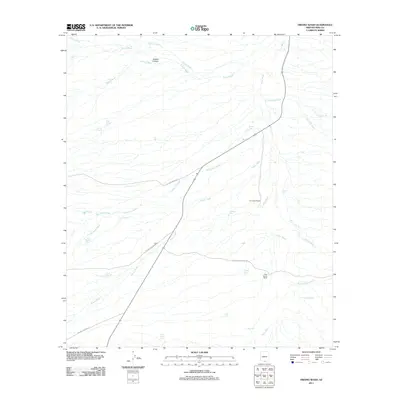
2011 Map of Fresno Wash
USGS Topo · Published 2011About this map
Altar Wash and Fresno Wash dominate this arid landscape in Pima County, Arizona, where a complex network of seasonal drainages defines the movement across the desert. These washes, including Chiltepines Wash and Brown Wash, are punctuated by water management features essential for cattle operations in the region. The presence of El Cazador Ranch and Pozo Nuevo Ranch suggests a landscape of active ranching, supported by numerous catchments like Pozo Nuevo Tank, Pajonal Tank, and Lilly Tank. The transportation network is built around local cattle routes, with El Khorn Ranch Rd and Las Delicias Ranch Rd providing access through the alluvial plains. This survey captures the infrastructure of the American Southwest's grazing lands, showing the locations of tanks and named canyons like Sabino Canyon that served as critical points for local livestock management during the early twenty-first century.
Find a feature on this map
33 named features on this map. Tap any name to fly to it.
Don’t see what you’re looking for? This feature index may not catch every label — zoom into the map to look around manually.
Map Details
Editions of this 2011 Fresno Wash Map
This is the sole edition of this map. No revisions or reprints were ever made.
Other maps of this area

1920 · Arivaca
USGS Topo · 1:125,000

1940 · Palo Alto Ranch
USGS Topo · 1:62,500

1941 · Presumido Peak
USGS Topo · 1:62,500

1941 · Baboquivari Peak
USGS Topo · 1:62,500

1941 · Arivaca
USGS Topo · 1:62,500

1943 · Fresnal
USGS Topo · 1:125,000

1943 · Arivaca
USGS Topo · 1:62,500

1943 · Palo Alto Ranch
USGS Topo · 1:62,500

1943 · Presumido Peak
USGS Topo · 1:62,500

1944 · Baboquivari Peak
USGS Topo · 1:62,500