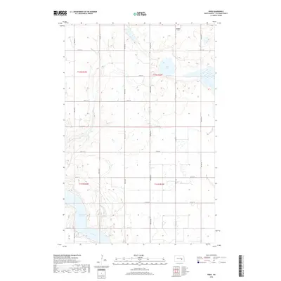
2018 Map of Fried
USGS Topo · Published 2018About this map
The Jamestown Reservoir and the winding James River dominate the southwestern corner of this North Dakota prairie landscape. This 2018 survey captures a region defined by its glacial hydrology and a precise grid of rural infrastructure, where section lines like 84th Ave SE and 27th St SE partition the open country. To the north, Blue Lake sits as a prominent natural basin amidst the rolling topography of Stutsman County. The presence of the Sprague Airport in the northeast corner highlights the importance of light aviation for local connectivity in these expansive agricultural townships. Navigated via Co Hwy 42, the area remains characterized by large-scale farming and the seasonal fluctuations of its wetland systems.
Find a feature on this map
22 named features on this map. Tap any name to fly to it.
Don’t see what you’re looking for? This feature index may not catch every label — zoom into the map to look around manually.
Map Details
Editions of this 2018 Fried Map
This is the sole edition of this map. No revisions or reprints were ever made.
Other maps of this area

1896 · Jamestown
USGS Topo · 1:125,000

1900 · Pingree
USGS Topo · 1:125,000

1900 · Pingree
USGS Topo · 1:62,500

1950 · Buchanan
USGS Topo · 1:24,000

1950 · Fried
USGS Topo · 1:24,000

1951 · Jamestown
USGS Topo · 1:24,000

1951 · Fried
USGS Topo · 1:24,000

1951 · Spiritwood Lake
USGS Topo · 1:24,000

1951 · Courtenay
USGS Topo · 1:24,000

1952 · Buchanan
USGS Topo · 1:24,000