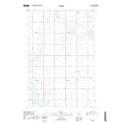
2020 Map of Fried
USGS Topo · Published 2020About this map
Jamestown Reservoir dominates the southwest corner of this Stutsman County landscape, its winding shoreline cutting through the prairie north of the city. The area is defined by a grid of rural sections typical of the high plains, where agriculture and water management shape the local geography. To the east, Blue Lake provides a natural landmark amidst the surveyed township lines of t142n r63w. For local history and genealogy, the Sacred Heart Cem stands as a focal point for the community's heritage near the center of the quadrangle. Transportation is anchored by Co Hwy 42, which bisects the region east-to-west, and the small Sprague Airport located in the northern reaches, supporting the agricultural operations and connectivity of this rural North Dakota territory.
Find a feature on this map
16 named features on this map. Tap any name to fly to it.
Don’t see what you’re looking for? This feature index may not catch every label — zoom into the map to look around manually.
Map Details
Editions of this 2020 Fried Map
This is the sole edition of this map. No revisions or reprints were ever made.
Other maps of this area

1896 · Jamestown
USGS Topo · 1:125,000

1900 · Pingree
USGS Topo · 1:125,000

1900 · Pingree
USGS Topo · 1:62,500

1950 · Buchanan
USGS Topo · 1:24,000

1950 · Fried
USGS Topo · 1:24,000

1951 · Jamestown
USGS Topo · 1:24,000

1951 · Fried
USGS Topo · 1:24,000

1951 · Spiritwood Lake
USGS Topo · 1:24,000

1951 · Courtenay
USGS Topo · 1:24,000

1952 · Buchanan
USGS Topo · 1:24,000