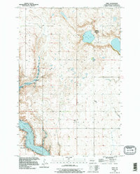
1990 Map of Fried
USGS Topo · Published 1995About this map
Jim Valley defines the western terrain of this Stutsman County landscape, where the seasonal hydrology of the prairie pothole region is evident through numerous small basins and larger bodies like Blue Lake. The map centers on the small community of Fried, a quiet settlement anchored by the Fried Cem and proximity to agricultural infrastructure, including a Substa and Comm Tower.
Find a feature on this map
11 named features on this map. Tap any name to fly to it.
Don’t see what you’re looking for? This feature index may not catch every label — zoom into the map to look around manually.
Map Details
Editions of this 1990 Fried Map
This is the sole edition of this map. No revisions or reprints were ever made.
Other maps of this area

1896 · Jamestown
USGS Topo · 1:125,000

1900 · Pingree
USGS Topo · 1:125,000

1900 · Pingree
USGS Topo · 1:62,500

1950 · Buchanan
USGS Topo · 1:24,000

1950 · Fried
USGS Topo · 1:24,000

1951 · Jamestown
USGS Topo · 1:24,000

1951 · Fried
USGS Topo · 1:24,000

1951 · Spiritwood Lake
USGS Topo · 1:24,000

1951 · Courtenay
USGS Topo · 1:24,000

1952 · Buchanan
USGS Topo · 1:24,000