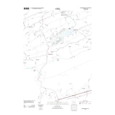
2013 Map of Friedensburg
USGS Topo · Published 2013About this map
Friedensburg and the surrounding valley settlements define this landscape between the ridge lines of Schuylkill Mountain and Blue Mountain. The area is characterized by a network of creeks, including Upper Little Swatara Cr and Red Cr, which support various recreational and agricultural sites. The residential community surrounding Lake Wynonah is a significant feature, with its intricate street names such as Teepee Dr and Canoe Dr reflecting the development around Fawn Lake.
Find a feature on this map
148 named features on this map. Tap any name to fly to it.
Don’t see what you’re looking for? This feature index may not catch every label — zoom into the map to look around manually.
Map Details
Editions of this 2013 Friedensburg Map
This is the sole edition of this map. No revisions or reprints were ever made.
Other maps of this area

1889 · Pottsville
USGS Topo · 1:62,500

1891 · Pottsville
USGS Topo · 1:62,500

1891 · Lebanon
USGS Topo · 1:62,500

1892 · Pine Grove
USGS Topo · 1:62,500

1893 · Lebanon
USGS Topo · 1:62,500

1899 · Lebanon
USGS Topo · 1:62,500

1902 · Wernersville
USGS Topo · 1:62,500

1943 · Lebanon
USGS Topo · 1:62,500

1943 · Wernersville
USGS Topo · 1:62,500

1944 · Pottsville
USGS Topo · 1:24,000
Featured Places
- Bethel Township, PA
- Friedensburg, Wayne Township
- Upper Tulpehocken Township, PA
- North Manheim Township, PA
- Upper Bern Township, PA