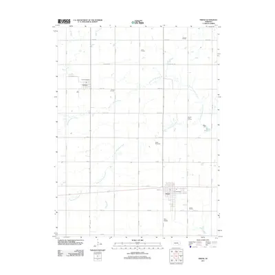
2011 Map of Friend
USGS Topo · Published 2011About this map
The agricultural plains of Saline County are defined by the community of Friend and the smaller village of Cordova to the north. This 2011 survey reveals a landscape organized by a precise grid of rural roads, including Yankee Hill Rd and Saltillo Rd, which cut across the meandering paths of North Fork Johnson Creek and South Fork Johnson Creek. The map is particularly notable for its density of small, named burial grounds that speak to the area's genealogical history, such as Saint Josephs Cemetery near the southern border and Leonard Cemetery in the north. Water management is a key feature of this prairie terrain, evidenced by structures like the Potter-Reich Dam and the Milton Reservoir, which support the local farm economy and regulate the flow of Indian Creek.
Find a feature on this map
29 named features on this map. Tap any name to fly to it.
Don’t see what you’re looking for? This feature index may not catch every label — zoom into the map to look around manually.
Map Details
Editions of this 2011 Friend Map
This is the sole edition of this map. No revisions or reprints were ever made.
Other maps of this area

1934 · Seward
USGS Topo · 1:48,000

1934 · Utica
USGS Topo · 1:62,500

1935 · Dorchester
USGS Topo · 1:48,000

1937 · Utica
USGS Topo · 1:62,500

1939 · Seward
USGS Topo · 1:62,500

1940 · Dorchester
USGS Topo · 1:62,500

1955 · Lincoln
USGS Topo · 1:250,000

1957 · Lincoln
USGS Topo · 1:250,000

1958 · Lincoln
USGS Topo · 1:250,000
1964 · Goehner
USGS Topo · 1:24,000