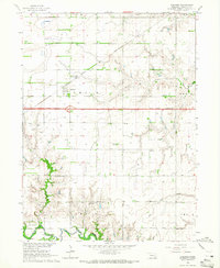
1964 Map of Goehner
USGS Topo · Published 1965About this map
The Goehner township in Seward County is captured here during a period of infrastructure modernization, most notably evidenced by the Interstate 80 corridor marked as Under Construction. This massive engineering project cuts east-to-west across the plains, passing just south of the established village of Goehner. The landscape is defined by the branching waterways of North Branch Crooked Creek and South Branch Crooked Creek, which feed into the wider basin of the West Fork Big Blue River at the southern edge of the sheet.
Find a feature on this map
26 named features on this map. Tap any name to fly to it.
Don’t see what you’re looking for? This feature index may not catch every label — zoom into the map to look around manually.
Map Details
Editions of this 1964 Goehner Map
2 editions found
Other maps of this area

1934 · Seward
USGS Topo · 1:48,000

1934 · Utica
USGS Topo · 1:62,500

1935 · Dorchester
USGS Topo · 1:48,000

1937 · Utica
USGS Topo · 1:62,500

1939 · Seward
USGS Topo · 1:62,500

1940 · Dorchester
USGS Topo · 1:62,500

1955 · Lincoln
USGS Topo · 1:250,000

1957 · Lincoln
USGS Topo · 1:250,000

1958 · Lincoln
USGS Topo · 1:250,000
1964 · Staplehurst
USGS Topo · 1:24,000