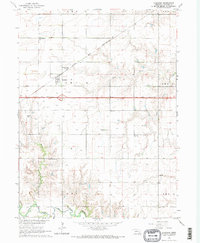
1964 Map of Goehner
USGS Topo · Published 1965About this map
Goehner serves as the central hub of this mid-1960s agricultural landscape, where the Chicago and North Western railroad cuts diagonally across the northern townships. The area is defined by its deep-rooted community foundations, evidenced by numerous rural institutions such as Star Sch, Salem Ch, and West Fairview Ch. The map captures a significant moment in the modernization of the Nebraska plains, documenting Interstate 80 as 2 lane under construction, a massive infrastructure project that would soon transform the local economy and travel patterns. To the south, the terrain descends toward the West Fork Big Blue River, while small tributaries like Walnut Creek and Coon Creek drain the surrounding fields. Genealogists will find considerable value in the detailed location of burial sites, including the Old Salem Cem and Perry Mound Cem near the prominent Perry Mound landmark.
Find a feature on this map
32 named features on this map. Tap any name to fly to it.
Don’t see what you’re looking for? This feature index may not catch every label — zoom into the map to look around manually.
Map Details
Editions of this 1964 Goehner Map
2 editions found
Other maps of this area

1934 · Seward
USGS Topo · 1:48,000

1934 · Utica
USGS Topo · 1:62,500

1935 · Dorchester
USGS Topo · 1:48,000

1937 · Utica
USGS Topo · 1:62,500

1939 · Seward
USGS Topo · 1:62,500

1940 · Dorchester
USGS Topo · 1:62,500

1955 · Lincoln
USGS Topo · 1:250,000

1957 · Lincoln
USGS Topo · 1:250,000

1958 · Lincoln
USGS Topo · 1:250,000
1964 · Staplehurst
USGS Topo · 1:24,000