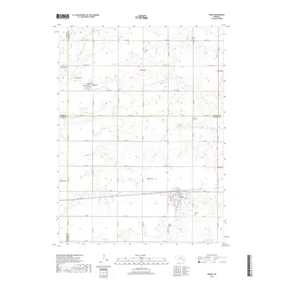
2017 Map of Friend
USGS Topo · Published 2017About this map
Friend anchors this agricultural landscape at the intersection of Saline, Fillmore, Seward, and York counties. The town's grid is well-established, serving as a hub for the surrounding rural sections. Further north, the smaller settlement of Cordova sits near the headwaters of Indian Cr, its streets including Hector St and Andromache St reflecting a distinct local naming pattern.
Find a feature on this map
40 named features on this map. Tap any name to fly to it.
Don’t see what you’re looking for? This feature index may not catch every label — zoom into the map to look around manually.
Map Details
Editions of this 2017 Friend Map
This is the sole edition of this map. No revisions or reprints were ever made.
Other maps of this area

1934 · Seward
USGS Topo · 1:48,000

1934 · Utica
USGS Topo · 1:62,500

1935 · Dorchester
USGS Topo · 1:48,000

1937 · Utica
USGS Topo · 1:62,500

1939 · Seward
USGS Topo · 1:62,500

1940 · Dorchester
USGS Topo · 1:62,500

1955 · Lincoln
USGS Topo · 1:250,000

1957 · Lincoln
USGS Topo · 1:250,000

1958 · Lincoln
USGS Topo · 1:250,000
1964 · Goehner
USGS Topo · 1:24,000