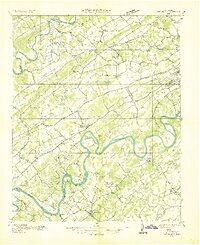
1936 Map of Friendship
USGS Topo · Published 1936About this map
The Tennessee River winds through a landscape of ridges and river bends in this mid-1930s survey, capturing the region just before significant hydro-electric development altered the waterway. The area is defined by the parallel elevations of Copper Ridge and Beaver Ridge, which channel the Beaver Creek and structure the settlement patterns of towns like Concord and Friendsville. The Southern Ry and L & N RR provide the industrial backbone, connecting riverfront landings with inland hubs like Farragut and Bearden.
Find a feature on this map
101 named features on this map. Tap any name to fly to it.
Don’t see what you’re looking for? This feature index may not catch every label — zoom into the map to look around manually.
Map Details
Editions of this 1936 Friendship Map
This is the sole edition of this map. No revisions or reprints were ever made.
Other maps of this area

1886 · Knoxville
USGS Topo · 1:125,000

1892 · Knoxville
USGS Topo · 1:125,000

1893 · Briceville
USGS Topo · 1:125,000

1894 · Knoxville
USGS Topo · 1:125,000

1895 · Loudon
USGS Topo · 1:125,000

1895 · Briceville
USGS Topo · 1:125,000

1895 · Knoxville
USGS Topo · 1:125,000

1896 · Briceville
USGS Topo · 1:125,000

1897 · Maynardville
USGS Topo · 1:125,000

1900 · Maynardville
USGS Topo · 1:125,000