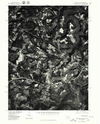
1977 Map of Friendsville
USGS Topo · Published 1979About this map
Friendsville sits along the winding path of the Youghiogheny River in this orthophotoquad, which captures the distinct borderlands of Maryland, Pennsylvania, and West Virginia in the late 1970s. The aerial imagery highlights the sharp contrast between the deeply forested river valleys and the cleared agricultural plots surrounding settlements like Markleysburg and Sand Spring. A central feature of the landscape is the Youghiogheny River Lake, its dark waters filling the jagged valley floor as the river flows northward. The orthophoto format provides a literal view of land use during this era, revealing the intricate network of farm roads, wooded ridges, and the small-town footprints of these Appalachian communities before later development altered the rural character of Garrett County and the surrounding tri-state area.
Find a feature on this map
5 named features on this map. Tap any name to fly to it.
Don’t see what you’re looking for? This feature index may not catch every label — zoom into the map to look around manually.
Map Details
Editions of this 1977 Friendsville Map
This is the sole edition of this map. No revisions or reprints were ever made.
Other maps of this area

1900 · Accident
USGS Topo · 1:62,500

1900 · Uniontown
USGS Topo · 1:62,500

1904 · Bruceton
USGS Topo · 1:62,500

1922 · Confluence
USGS Topo · 1:62,500

1926 · Bruceton
USGS Topo · 1:62,500

1931 · Uniontown
USGS Topo · 1:62,500

1931 · Confluence
USGS Topo · 1:62,500

1931 · Bruceton Mills
USGS Topo · 1:62,500

1933 · Confluence
USGS Topo · 1:62,500

1933 · Bruceton
USGS Topo · 1:62,500