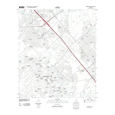
2010 Map of Friendswood
USGS Topo · Published 2010About this map
Clear Creek and its winding tributaries, including Cowards Creek and Chigger Creek, define the coastal prairie landscape of this southeastern Texas corridor between Houston and Galveston. By 2010, the region exhibits dense suburban development, particularly in the namesake Friendswood and Webster areas, where planned neighborhoods like Sterling Knoll and Pipers Meadow have replaced much of the original open acreage. Despite this growth, the area's industrial and aeronautical roots remain visible through the sprawling infrastructure of Ellington Field and the Friendswood Oil Field. Small pockets of early history persist amidst the modern grid, such as the Whitcomb Cemetery and the private airstrip at Polly Ranch Airport. The map documents a complex network of bayous, including Horsepen Bayou and Marys Creek, which continue to dictate the drainage and layout of the surrounding communities.
Find a feature on this map
121 named features on this map. Tap any name to fly to it.
Don’t see what you’re looking for? This feature index may not catch every label — zoom into the map to look around manually.
Map Details
Editions of this 2010 Friendswood Map
This is the sole edition of this map. No revisions or reprints were ever made.
Other maps of this area

1915 · Park Place
USGS Topo · 1:24,000

1915 · Deepwater
USGS Topo · 1:24,000

1916 · Genoa
USGS Topo · 1:24,000

1916 · Seabrook
USGS Topo · 1:24,000

1916 · La Porte
USGS Topo · 1:24,000

1919 · Deepwater
USGS Topo · 1:31,680

1920 · Seabrook
USGS Topo · 1:31,680

1920 · Genoa
USGS Topo · 1:31,680

1920 · Mykawa
USGS Topo · 1:31,680

1920 · La Porte
USGS Topo · 1:31,680